
Cuba and the Dominican Republic are island neighbors, but not pop-over-for-a-BBQ or lend-me-some-sugar kind of neighbors — It’s more of a Ned Flanders Vs. Homer Simpson sort of situation.
As the tourist capital of the Caribbean, the Dominican Republic worries that the improving relations between the US and Cuba will cut into their economy, especially as their similar climates mean they produce a lot of the same commodities and have a comparable appeal to travelers.
But just how close are these rival islands? Well, not as close as you might think when viewing the islands on a map — We’re talking 530 miles (853 km), centroid to centroid.
How Far Is Cuba From Hispaniola?
The reason that 530-mile (530.03 miles to be exact) distance seems a little off base (okay, a lot off base) is that, shore-to-shore, Cuba and its neighbor island are only separated by a minuscule 50 miles (80 km).
You could depart from the east coast of Cuba and reach your destination in next to no time by boat, and a couple of minutes by plane.
However, you might be in for a surprise, as you wouldn’t be arriving in the Dominican Republic.
The island in question is actually called Hispaniola, and it’s split into two discrete countries, the Dominican Republic and Haiti, and it just so happens that the entire west coast of Hispaniola is Haiti.
To reach the border, (or the coast if you were heading from DR to Cuba), you’d need to traverse the entire western third of Hispaniola, which is where those 480 additional miles come from.
Assuming you were making this part of the trip on a bus, you’d be in for a pretty hefty journey.
How Long Would It Take To Get To Cuba From The Dominican Republic?
Obviously your mode of transportation is going to determine how long it would take you to get to Cuba from the Dominican Republic (or vice versa). So let’s assess the possibilities.
How Long Would It Take To Fly From The Dominican Republic To Cuba?
The typical passenger plane flies at around 560 miles per hour, which means you would touch down in Cuba after a leisurely 57-minute flight — Not bad, right?
That’s barely enough time to finish your in-flight meal.
How Long Would It Take To Get To Cuba From The Dominican Republic Using Alternative Transportation?
Another option would be to sail from either the north or south coast of the Dominican Republic and make a bee-line for the Eastern coast of Cuba.
If you were charting a course from the north coast and you wanted to reach land as quickly as possible, your best bet would be to head for Baracoa, on the eastern tip of Cuba.
Make sure to keep your bearings, though, as a short detour in a southwesterly direction will leave you slap bang in the middle of Guantánamo Bay, the US naval base.
It’s a 205.19 nautical mile journey.
Considering a cruising sailboat will top out at about 6 knots, it can travel 1 nautical mile in 10 minutes, and you’d be traveling for approximately 34 hours and 20 minutes.
Setting sail from the south coast would extend your travel time significantly, as you’d have to travel west to circumnavigate the long Haitian strip that terminates with Les Cayes and Jérémie, before heading northwest to Santiago de Cuba.
That said, traveling by car and then catching a flight in Haiti would cut your journey down to little over 5 hours.
What’s The Shortest Distance Between Major Cities Of The Dominican Republic And Cuba?

The two closest major cities of these Caribbean countries are Moa (Cuba) and Santiago de los Caballeros (Dominican Republic).
A direct route between these two cities would be roughly 289 miles (465 km), which could be flown in next to no time, although it’s still quite a distance to sail.
What’s The Shortest Distance Between The Dominican Republic And Cuba Based On Main Borders?
The shortest possible direct route from the Dominican Republic to Cuban territory is actually only just over 165 miles (266 km), but there would be no way to make this trip efficiently, so you’d be better off taking a more meandering route.
What’s The Distance Between The Capital Of Cuba And The Capital Of The Dominican Republic?
The capital of Cuba is the infamous Havana, which is situated in the heart of the La Habana Province on the north coast of the island nation, close to the western shore, meaning it’s almost as far away from The Dominican Republic as it can possibly be.
The capital of the Dominican Republic is Santo Domingo, the oldest permanent city founded by Europeans in the entire Western hemisphere.
Santo Domingo is situated on the southeast coast of the Dominican Republic and island of Hispaniola, alongside the mouth of the Ozama River.
In other words, it’s almost as far away from Cuba as it could possibly be.
In light of this, to get from one capital city to the other, you’d have to travel a whopping 869 miles (1398 km), which would take about 2 hours and 15 minutes on a direct flight, but for journeys with connections, you’re looking at something more to the tune of 4 hours and 15 minutes.
Distance Between The Dominican Republic And Cuba By Cities
To wrap things up, let’s take a look at the distance between the major cities of Cuba and the Dominican Republic, just in case you’re looking for details on a very specific journey you have in mind.
- Santa Clara in Cuba to Santiago de los Caballeros in the Dominican Republic is 632.5 miles (1016 km).
- Matanzas in Cuba to Santiago de los Caballeros is 743.8 miles (1197 km).
- Cárdenas in Cuba to Salcedo in the Dominican Republic is 740 miles (1191 km).
- Santiago de Cuba to Azua is 350 miles (563 km).
- Cienfuegos in Cuba to Santo Domingo (Capital of the Dominican Republic) is 730 miles (1175 km).
- Las Tunas in Cuba to Salcedo is 438 miles (705 km).
- Moa to Santo Domingo is 289 miles (465 km).
- Matanzas to Santo Domingo is 818.3 miles (1317 km).
- Moa to Santo Domingo is 362.3 miles (583 km).
- Cárdenas to Santo Domingo is 796 miles (1281 km).
- Havana (Capital of Cuba) to Santo Domingo is 869 miles (1398 km).
- Holquin in Cuba to Santo Domingo is 447 miles (719 km).
- Las Tunas to Azua is 440 miles (708 km).
- Guatanamo in Cuba to Salcedo is 316.2 miles (509 km).
Final Thoughts
There you have it — Cuban centroid to Dominican centroid, you’re looking at a distance of 530 miles, which, in ideal circumstances could be traveled by plane in about an hour.
Making this international trip via the shortest nautical route would take significantly longer.
Major border to major border, the shortest direct distance between the island nations is the 289 miles that separate Moa in Cuba from the Dominican capital of Santo Domingo; however, a trip from Santo Domingo to Cuban capital Havana would be much longer.
Between the two capital cities lies an 869-mile stretch, as Havana is situated near the western end of Cuba, while Santo Domingo is situated towards the eastern end of Hispaniola.

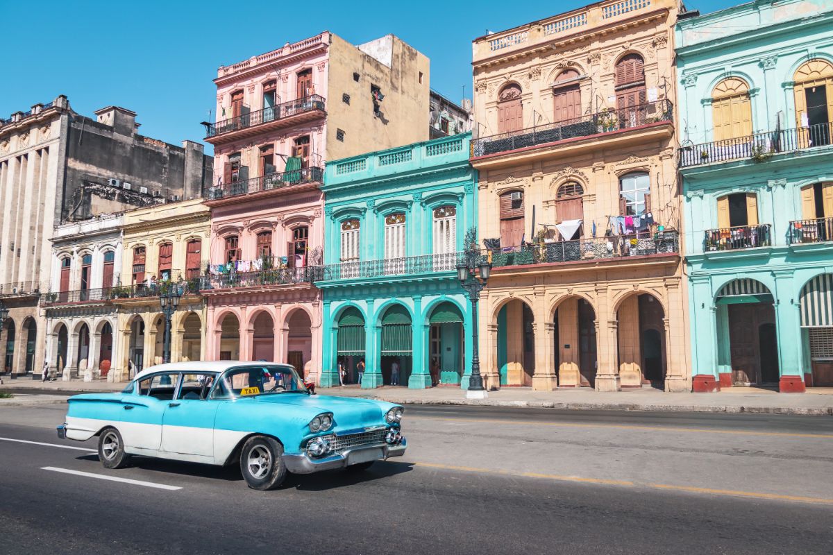
Once I got here, I fell in love. The buildings, the beaches, the monuments - I was in awe. I went on a different sightseeing walk every single day and never got bored of the city, which I had found to be a common issue while traveling through other places.
It just made sense for me to stick around in Havana from then on out. I never had the urge to keep backpacking, and I certainly didn’t want to return home to Utah now that I had seen this.
So, if you’re thinking of visiting Havana, stick around and learn more about the city from my website. Who knows, maybe I’ll see you out here!
- What Is The Largest Island In Cuba? - September 19, 2022
- Havana – Why Is It Cuba’s Most Exciting City? - September 19, 2022
- Cheapest Time To Visit Cuba (Ultimate Guide) - September 19, 2022
Related Posts:


")


